The basics of the greenhouse mechanism leading to global warming have been understood for over a century. In a simplified manner, heat emitted by the earth surface is intercepted (absorbed) by greenhouse gases (GHG). GHG in turn reemit the heat which is re-absorbed by the earth surface and then re-emitted to the atmosphere… The heat involved in this process is therefore “trapped” in the atmosphere. In principle it is very similar to the glass walls and roof of a greenhouse trapping heat and warming the interior, hence the term ‘greenhouse effect’. It’s easy to understand that the more GHG the atmosphere contains, the stronger will be the warming effect.
After having established the main mechanism, we can deduce a few consequences that allow to understand some known impacts of climate change, without the use of any equation.
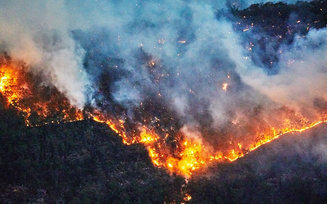
In the last 50 years, satellite technology has allowed us to comprehensively track tropical cyclones (aka hurricanes, typhoons, tropical storms). Before this period, we relied on ship reports and observations once the storm reached land, leading to biases in the data. These biases can be corrected but records have improved significantly due to satellite technology. While the global frequency of the tropical cyclones has not shown to follow a particular trend, we do observe an increase in the intensity of the events.
“Increasing the temperature gradient between the lowest and uppermost atmosphere means...more powerful forces and more extreme hurricanes.”
Jaime Lezama,
Associate Director, Climate and Resilience Hub
As we said, earth surface is warming up and so does the evaporation of water, creating an excess of water vapor (which is a GHG) near the surface. This means that an increasing proportion of the Earth’s emitted heat is absorbed near the surface. If the proportion of heat absorbed near the surface increases, a lower proportion reaches the upper atmosphere. Indeed, while in the lower atmosphere (where we live) temperature is increasing, the opposite is happening to higher altitudes where the temperature is decreasing.
In simple terms, weather forms where there are atmospheric gradients, or differences. Unluckily for us, it’s this temperature difference between the lower and the upper atmosphere that fuels many meteorological phenomena such as severe convection driving thunderstorms, tornadoes, and even hurricanes. Increasing the temperature gradient between the lowest and uppermost atmosphere means that the engine running these convective phenomena is being boosted, resulting in more powerful forces and more extreme hurricanes.
In recent years north America and Europe have experienced severe winter blizzards. In February 2021, winter storm Uri paralyzed the North America becoming the deadliest winter storm since 1996.
“In February 2021, winter storm Uri paralysed North America becoming the deadliest winter storm since 1996.”
Geoffrey Saville,
Head of Weather and Climate Risks Research
Phenomena consist in the appearance of freezing blasts coming from the Artic reaching temperate zones. But what is driving these severe cold events that might seem to contradict global warming trends?
While the complete explanation of this phenomena is complex, a primary satisfactory explanation can be obtained by understanding the basic atmospheric circulation over the Arctic. Cold air over the Arctic meeting warmer air from the mid latitudes induces a jet stream of high winds in the upper atmosphere that circumnavigates the globe and delineates the so called “polar vortex”, separating it from the south warmer atmosphere. Polar vortex boundaries can occasionally be destabilized leading to the appearance of “holes” from where Arctic cold air can escape to the south. This phenomena is natural and well known by meteorologists and dictates much of how we can forecast the day to day weather.

As the temperature increases in the planet over a longer timescale, so does melting of the sea ice in the Arctic. As a result, heat that was previously reflected back out to space by the ice is now absorbed by the oceans and remitted into the lower atmosphere, which in turn accumulates more heat, increasing the pace at which the sea ice continues to melt. This positive feedback loop, driven by the different in reflectivity of snow and ice vs ocean surfaces, known as the ‘albedo effect’ leads to Arctic amplification; a term used to describe the reason why the Arctic is increasing its temperature at a much higher pace than the rest of the planet. Under these conditions, the warming of the Arctic amplifies the polar vortex, so that when destabilization occurs, there is potential for greater temperature differences, theoretically leading to the potential for more extreme weather, in the form of the extraordinary winter blizzards experienced in recent years, as well as extreme heat waves.
Membership applies to $168 billion of assets under management across Willis Towers Watson’s discretionary asset management mandates