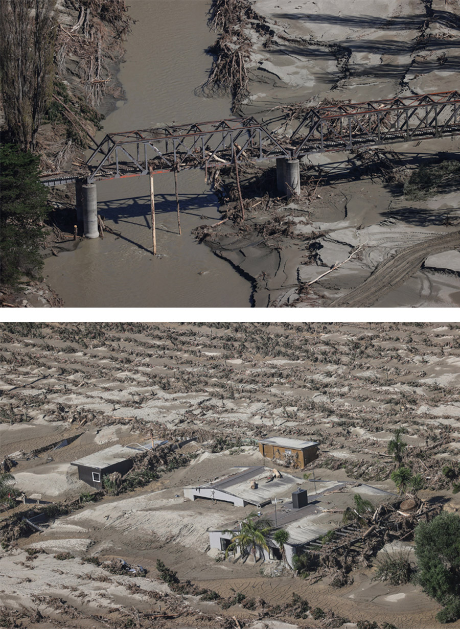
New Zealand declared only its third-ever national state of emergency in February following Cyclone Gabrielle, which damaged property, infrastructure and crops across the North Island. The government estimated that economic losses from the event will be at least NZ$13.5 billion ($8.4 billion), second only to the 2011 Christchurch earthquake. According to PERILS AG, insurance claims currently stand at around NZ$2 billion (U.S.$1.3 billion).
Gabrielle formed as a tropical low off the coast of the Solomon Islands on February 5, before moving south across the Coral Sea and strengthening into a Category 3 tropical cyclone. As the storm approached New Zealand, it weakened and underwent extratropical transition, unleashing heavy rain and strong winds on the North Island for three days between February 12 and 14. Several meteorological stations in New Zealand saw record or near-record summer wind gusts, while storm surge levels peaked at 0.7m, according to the National Institute of Water and Atmospheric Research (NIWA). The most damaging feature of the storm was heavy rainfall, with NIWA reporting record or near-record totals across much of the North Island, particularly on the East Coast around Gisborne and Hawke’s Bay.
The rain landed on already saturated ground. The summer of 2022/2023 was the second wettest on NIWA’s records for the North Island, and only a few weeks earlier Cyclone Hale caused 1-in-200 year flooding in Auckland. As a result, the rivers responded swiftly to Gabrielle’s precipitation. New high-flow records were set, with many gauging stations judged to be in excess of a 1-in-500 year return periods[1]. On the River Esk, families reported having to climb out of the windows of their properties to await rescue on their roofs, with some estimating that water levels rose by 3 meters in just 10 minutes.