Morocco’s 2023 earthquake is the second catastrophic earthquake in living history to strike far from the Atlas Mountains plate boundary. The region’s return period for Mw ≥ 6.8 events is around 20,000 years versus 200 years in the San Francisco Bay Area. Bay Area buildings would fare better, but insured losses would be much higher.
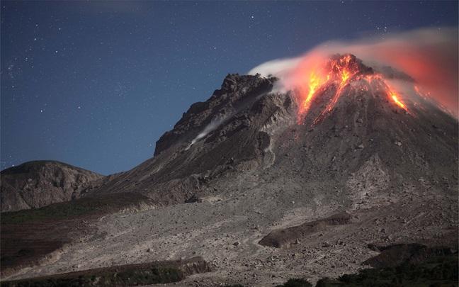
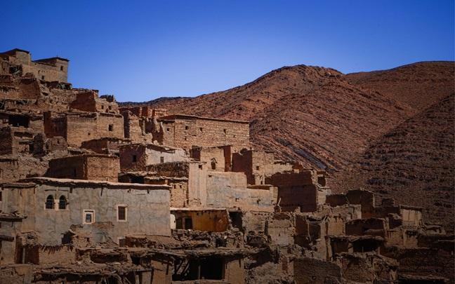
On September 8, 2023, just after 11:00 p.m. local time, a moment magnitude (Mw) 6.8 earthquake ruptured a remote, mountainous region 75 kilometers southeast of Marrakech. Nearly 3,000 people died, at least 5,600 were injured, and tens of thousands of dwellings were damaged or destroyed.[1] The U.S. Geological Survey (USGS) estimated that economic losses could be up to US $11 billion, equivalent to 8% of the country’s GDP. As bad as this was, the 1960 Mw 5.9 Agadir earthquake — 1/20th the size of the Mw 6.8 — killed at least 12,000 people and injured 25,000 out of a population of around 40,000 in a similar tectonic setting, 100 kilometers to the southwest. In contrast, about 100,000 people in isolated mountain villages were subjected to strong shaking in the 2023 earthquake. The lower death toll in 2023 in a far larger earthquake might be related to the widely distributed population in the mountains compared with the densely populated coastal city of Agadir, or it could indicate progress in building resilience.
U.S. Geological Survey (USGS) estimated that:
US $11 billion economic losses
8% of the country’s GDP
Both earthquakes struck far from the plate boundary that lies 500 kilometers to the north, running along Algeria, northern Morocco, southern Spain and Portugal.[2] There, the Nubian (African) plate collides with the Eurasian plate at a rate of about 6 – 10 millimeters per year. Among the best-known and destructive events to have struck on the plate boundary are the Great Lisbon Earthquake of 1755, which had an estimated magnitude of Mw 7.6, and the Mw 7.1 1980 El Asnam Earthquake in Algeria.[3] However there is only a modest contraction rate of approximately 1 millimeter per year across the Atlas Mountains where the 1960 and 2023 shocks occurred, which drives the much rarer compressional earthquakes.[4]
Mw 7.6 estimated magnitude of Great Lisbon Earthquake of 1755
Mw 7.1 estimated magnitude of El Asnam Earthquake of 1980
To put the recent event into context, it can be examined alongside Temblor’s Morocco earthquake event set. EventSet is a globally uniform 50,000-year stochastic event set for Mw ≥ 5 earthquakes. It includes point sources (epicenters) for Mw < 7 earthquakes and extended sources (in other words, fault-like ruptures) for larger events. EventSet shows that the site of the September 8, 2023 event is, in fact, among the seismically quieter zones in the country (Figure 1). In contrast, north central Morocco, which extends south from the African-Eurasian plate boundary, is much more seismically active. For the country as a whole, the return period for a Mw 6.8 earthquake is 90 years, but for a similar earthquake within 100 kilometers of the September 8, 2023 epicenter, it is about 20,000 years.

Source: Temblor
Twenty thousand years is a startlingly long return period for an earthquake, making this an incredibly rare occurrence. By comparison, within 100 kilometers of San Francisco, the return period of Mw 6.8 shocks is around 200 years (and Mw ≥ 6.8 events occurred there in 1868 and 1906), so these events are 100 times more likely than earthquakes of a similar magnitude in the Atlas Mountains.
This means that over a 20,000-year period, we would expect one Mw 6.8 event in the Atlas Mountains, while we would expect 100 events of the same magnitude in the Bay Area. Another attribute of the long return period is a lengthy aftershock sequence, as the two durations are coupled. So, while in the Bay Area, aftershocks would disappear within several years, it is highly likely that the Morocco aftershocks will continue, albeit at a much lower rate, for several centuries.
This means that Morocco’s hazard is now much higher near the Mw 6.8 epicenter than it was before the mainshock and will remain so indefinitely.
The return periods of a Mw 6.8 earthquake in the Atlas Mountains and one in the Bay Area are vastly different, and so would be the consequences. While building resilience is far better in California than it is in Morocco, so is insurance uptake; despite less damage occurring to buildings, insurance losses would likely be far higher in the Bay Area.
There is no network of accelerometers for measuring ground shaking in this region, so it must be estimated from modeled sources, such as Temblor and the USGS; however, these often show large differences. For example, in Temblor’s event footprint, shaking is profoundly amplified in sedimentary basins (Figure 2), a feature argued to be common to all earthquakes. Importantly, the largest settlements and many of the highest occupant-reported intensities are located in these sedimentary basins. By comparison, the USGS footprint has a more muted influence of the basins, but shaking intensities are generally about twice as high as those estimated by Temblor. Who’s right?

Source: Temblor
In the absence of a network of accelerometers, we may never know, although cell phone accelerometers may provide an invaluable source of measurements in the future. There is only one instrumental recording at 250 kilometers from the epicenter.
A significant difference between the methodologies is that the USGS model is adjusted by occupant-reported shaking intensities, which are then converted into pseudo-accelerations (Figure 3).

Source: Temblor[5]
These “Did You Feel It?” observations effectively double the modeled shaking. Within 60 kilometers of the epicenter, the converted intensities suggest shaking 10 times higher than the raw USGS model, at over 100% the force of gravity (g) (red dashed line in Figure 3); these are unlikely to be correct. Furthermore, the wide dispersion of intensities in Marrakech — from a barely felt 4% g to a devastating 55% g — points to the variation in building fragilities rather than a large variation of shaking within the city.
Morocco was extremely unlucky to have suffered a Mw 6.8 earthquake in a remote mountainous area, exposing seismically vulnerable buildings and an unprepared population to strong shaking. Nevertheless, the significantly lower fatality rate in 2023 compared with the much smaller 1960 Agadir earthquake may point to progress in Morocco’s construction. While an event of the same magnitude in the more seismically prepared San Francisco Bay Area would cause far less damage than in Morocco, it is also far more likely, and its financial cost would be far higher.
The 2023 event in Morocco (along with events in Turkiye and Afghanistan in 2023) underscores the importance of prolonged, consistent efforts to strengthen resilience against such devastating occurrences that pose a risk to a large number of people worldwide. Many rural buildings in these regions are unreinforced masonry, which crumble when shaken, whereas many buildings in urban areas are not compliant with local building codes and so collapse when subjected to earthquake accelerations.