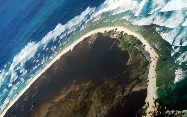
Can we know more about flood risk beyond conventional analysis on so much ‘observed’ data?
Artificial intelligence (AI) and machine learning (ML) have become buzz words over the last five years or so. In pretty much every industry, people are looking for ways to automate business processes, to reduce manual labour, increase efficiency and reduce errors.
Specifically in insurance, these technologies raise the question of whether it’s possible to see more in the information we have on particular risks. Can we know more about flood risk beyond conventional analysis on so much ‘observed’ data? Can we teach the machines to see the intricate details of existing data, and make correlations and connections which are imperceptible to the human observer to give us a fuller picture? With AI and ML techniques, the answer is yes!
With the technology getting better and better each day, ML is increasingly finding applications in assessing flood risk. Flooding is one of the most complicated natural perils we deal with in the risk management industry, perhaps because the ‘observed’ data is the most fragmented of any natural peril. It’s therefore the ideal candidate to use ML to improve understanding.
So far, we have seen ML applications in industry exposure datasets, satellite imagery, terrain data corrections, near real-time flood forecasting and even being used onboard cubesats - very large constellations of small, nano satellites - for rapid disaster response assistance and other services. The latter application has been developed by a group of researchers that participated in the Frontier Development Lab (FDL) challenge in 2019.
Most companies can get overwhelmed with the amount of ‘raw’ data that needs processing.
While the insurance industry sees the importance of using satellite imagery for managing flood risk, most companies can get overwhelmed with the amount of ‘raw’ data that needs processing. Lack of timely flood map production and delivery are also limitations.
But solutions are in hand. The FDL – “Space Challenge Sprint” supported by the National Aeronautics and Space Administration (NASA) and the European Space Agency (ESA) Φ-lab, along with associated partners, addresses a number of “hot topic” problem areas and works on solutions based on the newest advances in AI/ML methods, space exploration, and Earth Observation (EO).
The FDL researchers have created and curated a unique living database of flood events based on EO data for training a ML model that is computationally light enough to be deployed on a GPU chip onboard a (series of) cubesat(s). The goal is to rapidly detect and map flooded areas all around the globe, thereby eliminating the latency in satellite image delivery. The ML model called WorldFloods is now being tested in orbit as part of an experimental flight project. If successful, and when operationally deployed in a not-so-distant future, WorldFloods could be a game-changer for a number of sectors, including disaster response and water resources management. For the (re)insurance industry faster event information could be critical for claims handling, loss adjusting and parametric pay-outs.
WorldFloods could be a game-changer for a number of sectors, including disaster response and water resources management.
When it comes to observing floods, cloud cover is also a major issue. Together with ESA Φ-lab, WTW is involved with another interesting flood mapping application project - FloodSENS. FloodSENS develops an ML-based software application that will be deployed on an online EO cloud-computing platform to rapidly reconstruct flooded areas under cloud cover in optical satellite images. This is achieved by training the ML algorithm using relevant additional geospatial datasets, such as digital elevation models and water flow grids, as well as high-resolution and high-cadence flood labels from drones and very high-resolution commercial satellite imagery. When operationally deployed on the online EO processing platform WASDI , the trained model will use free lower resolution satellite imagery and globally available auxiliary datasets to estimate flooded area under clouds. The application could be run on an event basis or using an archive of flood images. The resulting flood maps would massively increase the information available during a high-impact flood event and also, in terms of reanalysis of historical flood observations, allow us to build better global flood risk indicators.
WTW, via the Willis Research Network, will continue to monitor, and collaborate with, these projects to bring the latest techniques and scientific advances to the risk management and insurance industry, as we seek to improve our understanding of flood risk and improve resilience to this devastating natural peril.